Chirripó National Park: hiking Costa Rica's highest peak
How fit do I need to be for Cerro Chirripó?
Very fit. The standard route is 18.5km each way from San Gerardo de Rivas, with approximately 2,500m of elevation gain. Summit day (if you stay at Crestones Base Lodge) runs 6 to 8 hours up and 4 to 6 hours down. You need regular hiking fitness and ideally some experience with multi-hour ascents at altitude. The trail is safe but genuinely strenuous.
The highest point in Costa Rica and southern Central America
Cerro Chirripó, at 3,821m, is the highest peak in Costa Rica and the fifth-highest mountain in Central America. The national park that surrounds it — Parque Nacional Chirripó — covers 50,150 hectares of páramo (high-altitude grassland), cloud forest, and sub-alpine ecosystems that feel utterly unlike the tropical Costa Rica most visitors encounter.
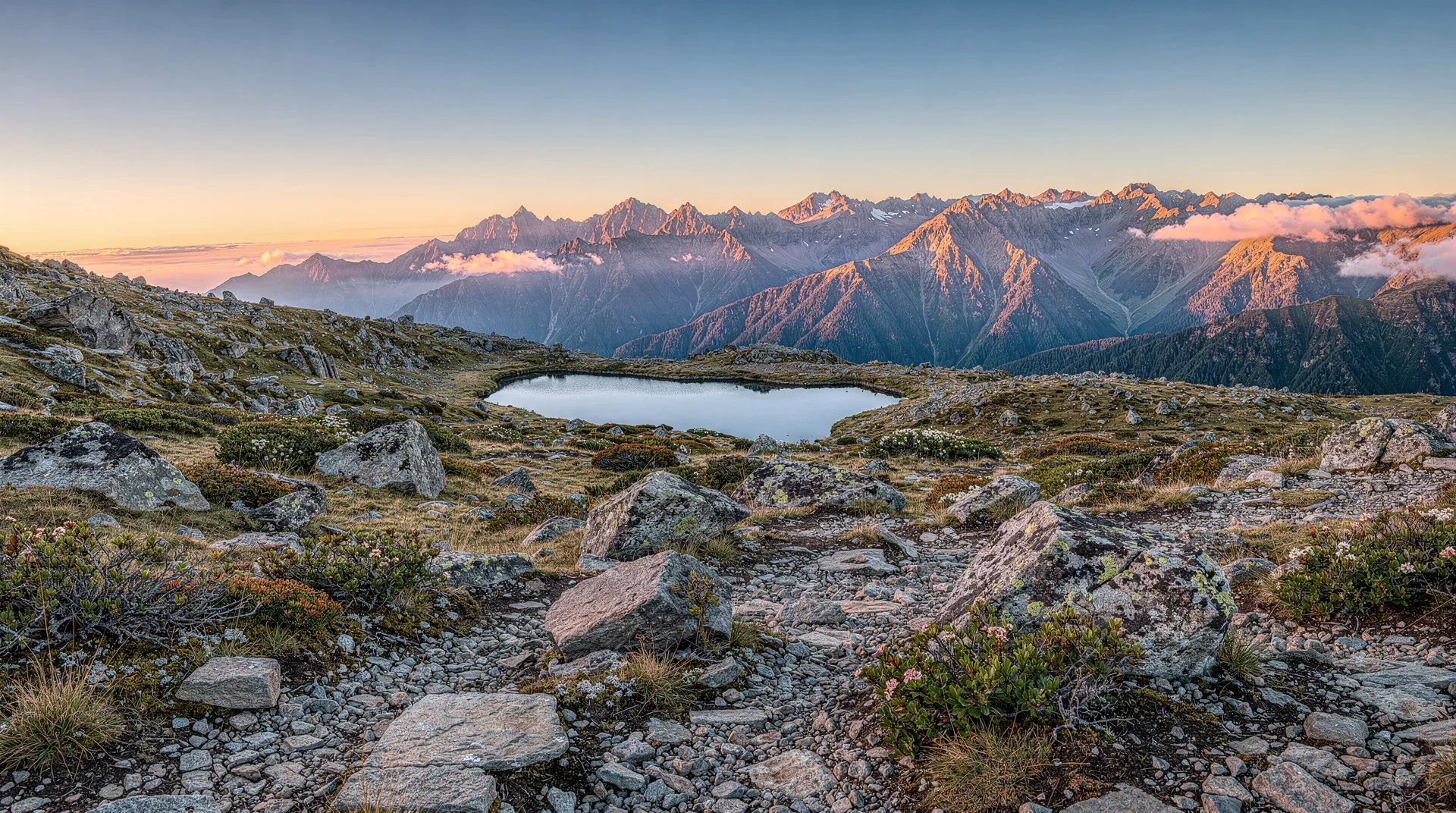
Standing on the summit, the landscape below is not jungle or beach — it is a high, wind-swept plateau scattered with glacial lakes (the legacy of the Pleistocene ice ages), stunted oak forest, and a boulder field that extends to the horizon. On a clear day, you can see both the Pacific and Caribbean coasts. The temperature drops to 0°C or below on most nights at the summit plateau, and frost on the tent or ground is routine in the dry season.
The mountain is a serious undertaking. It is not a nature walk or a casual hiking excursion — it is a 37km round-trip at high altitude with a full overnight stay required. Yet it is also not technical climbing. The trail is clear, well-maintained, and requires no ropes, harnesses, or specialist mountaineering skill. What it requires is fitness, preparation, and honest self-assessment about your physical capability.
The permit system: absolutely essential
SINAC strictly controls access to Chirripó. The daily quota is 40 hikers per day (including guides and porters). All visitors must have:
- A park entrance permit (purchased online through SINAC’s reservation system)
- A confirmed bed at Crestones Base Lodge (the only accommodation inside the park)
Both must be booked simultaneously through SINAC’s portal. The system opens reservations 2 to 5 months in advance — for peak dry-season months (December to April), slots fill within hours of opening. Set a calendar reminder and book the moment the window opens.
Costs:
- Park entrance fee: approximately $18–22 per person per day (2026 pricing — verify with SINAC)
- Crestones Base Lodge: approximately $30–35 per person per night (dormitory, 30 beds per room)
- Optional porter service: $30–50/day (can carry up to 14kg — highly recommended for first-timers)
The SINAC portal is at sinacweb.sinac.go.cr. It can be unreliable under heavy load on booking-open days — have a backup device ready.
The route from San Gerardo de Rivas
The standard and only legal hiking route begins at the park entrance ranger station in San Gerardo de Rivas, a village 20km south of San Isidro de El General.
San Gerardo de Rivas to Crestones Base Lodge:
- Distance: 14.5km
- Elevation gain: approximately 2,000m
- Typical time: 8 to 10 hours (first-timers may take 12 hours)
- Terrain: First 5km through cloud forest, then increasingly exposed páramo and moorland
The trail is consistently steep — there is no gentle warm-up gradient. The first 3km gain 500m of elevation. Experienced hikers moving well can reach Crestones in 6 to 7 hours. Slower hikers should budget 10 to 12 hours and start no later than 3am if attempting summit on the same day as arrival.
Crestones Base Lodge to summit:
- Distance: 4km from the lodge
- Additional elevation: 450m
- Typical time: 2 to 3 hours up, 1.5 to 2 hours down
Most hikers sleep at Crestones (arriving day 1 afternoon/evening) then rise at 3am to reach the summit for sunrise. The summit plateau (Valle de Los Conejos) is reached first, followed by the final boulder scramble to the Chirripó summit marker.
Cerro Chirripó tour: ascent to land of eternal waters — from $595Crestones Base Lodge
Crestones is the only accommodation inside the park. It is basic but functional: dormitory bunk beds, cold showers, a basic kitchen selling hot meals (pre-order dinner and breakfast when booking), and a ranger presence. Bring warm layers — temperatures at 3,400m drop to 0 to 5°C at night even in dry season. A sleeping bag rated to 0°C is essential.
The lodge also serves as the coordination point for guides and porters. If you hired a porter to carry your gear from San Gerardo, they will meet you at Crestones.
Fitness preparation
Be realistic. The most common reason for turning back before the summit is underestimating the physical demand. If you do not currently hike regularly with significant elevation gain, Chirripó will be extremely difficult.
Minimum preparation recommendation:
- At least 3 to 4 months of regular hiking, including trails with 500m+ elevation gain
- Cardio fitness equivalent to 45 to 60 minutes of sustained aerobic exercise
- Previous overnight camping or hiking experience helpful
Altitude: At 3,821m, altitude can affect visitors from sea level. Symptoms (headache, nausea, fatigue) are possible. Sleeping one night in San Isidro de El General (700m) or San Gerardo de Rivas (1,300m) before the hike helps acclimatise.
Training that actually helps
The best preparation is the mountain’s own profile: long, sustained climbs with a loaded pack. Flat running builds general fitness, but it does little for the grind of a trail that never lets up. If you live somewhere flat, stair sessions and weighted walks are a reasonable substitute, and the final weeks should include at least a couple of full-day hikes in the boots you plan to wear. Our hiking Cerro Chirripó guide goes deeper on trail logistics, and the destination page for Cerro Chirripó sets the mountain in its regional context.
If you want a feel for how your body handles a long day on foot before committing to the permit and lodge booking, a guided hiking day near the capital is a low-stakes test run, such as a guided hiking day out of San José — from $95 . It will not replicate the altitude, but it will show you how you cope with pace, pack weight, and an early start.
Pay attention to your feet and knees. The descent punishes both, and many hikers who sail up find the way down the harder half. Trekking poles, well-worn boots, and a gradual pace in the first hours all help you arrive at Crestones with energy left.
What to pack: the non-negotiable gear list
The mountain has no shelter between the park entrance and Crestones Lodge except for one emergency shelter at the midpoint.
Essential:
- Sleeping bag (0°C rated minimum)
- Waterproof rain jacket and rain trousers
- Insulating mid-layer (fleece or down)
- Hiking boots with ankle support (not trail runners — the terrain is rough)
- Trekking poles (strongly recommended — the descent is very hard on knees)
- Headlamp with spare batteries (for the 3am summit push)
- At least 3 litres of water capacity (refill points exist on trail but verify with rangers)
- High-energy food — the lodge meals are basic
- Warm hat and gloves for the summit
Leave behind: Heavy camera gear, alcohol (not permitted in the park), anything non-essential. The less you carry, the more you enjoy it.
Best season to climb
January to April: The main dry season. Clearest summit views, coldest nights (more frost). The most popular period and the hardest to secure permits.
May to June and September to October: Shoulders of rainy season. Some rain, but not the full deluge of July–August. Permits easier to secure. Summit views possible, though cloud is more frequent.
July to August: The wettest period. Trails can be muddy and slippery. Summit views are frequently clouded. Not recommended for first-timers. Permits are easier to get — but for good reason.
December: The beginning of dry season. Increasingly popular with permit windows filling fast.
Pacing yourself on the way up
Start slowly. The cloud forest section at the beginning is where many hikers burn energy they will want later, because the early kilometres feel manageable and the instinct is to push. Settle into a rhythm you could hold for hours, take short, frequent breaks to drink and eat, and resist comparing yourself to faster groups. Mornings in the lower forest are usually the clearest part of the day, and clouds often build as the hours pass, so an early start helps with both comfort and views.
Eat before you feel hungry and drink before you feel thirsty. At altitude both signals arrive late, and a flat, tired feeling on the upper moorland is often just under-fuelling. If a headache, nausea, or dizziness builds and does not ease with rest and water, tell a ranger rather than pushing on.
Looking beyond the summit
Chirripó rewards a slower schedule. If your permit allows a second night, the extra time lets you explore the glacial lakes and the open páramo without a deadline, and it gives tired legs a rest before the long descent. The surrounding highlands are also some of the best cool-climate birding in the country; the quetzal watching guide and the San Gerardo de Dota cloud forest page are useful companions if birds matter to you, and the broader bird watching by region guide helps you plan the rest of the trip.
Getting to San Gerardo de Rivas
San Gerardo de Rivas is the gateway village, located in a steep valley below the park entrance.
From San José: 3.5 to 4 hours by car via San Isidro de El General (Highway 2, the Panamerican). San Gerardo is 20km further on a steep mountain road — a 4WD is not required but helpful in rainy season.
By bus: Tracopa buses from San José to San Isidro, then a local bus or taxi to San Gerardo. A full-day journey — plan to arrive the day before the hike.
From Uvita: 2 hours via San Isidro.
Frequently asked questions about Chirripó National Park
Can I hire a guide?
Guides are not mandatory at Chirripó (unlike Corcovado), but are recommended for first-time visitors. Guides from San Gerardo de Rivas are familiar with the route, weather patterns, and wildlife. They also ensure you do not navigate incorrectly in poor visibility.
Is portering worth it?
For most non-professional hikers, yes. Having a porter carry your sleeping bag, food, and extra clothing (up to 14kg) makes a substantial difference to your energy on the ascent. The cost ($30–50/day) is modest relative to the physical benefit.
What happens if the weather turns bad at the summit?
The summit plateau can experience rapid weather changes — sun to thick fog in twenty minutes. Guides and rangers monitor conditions. If weather looks dangerous, rangers may restrict summit access. The summit marker itself is clearly signed and the trail back to Crestones is easy to follow in most conditions.
Are there other trails in the park besides the main route?
Yes. From the Crestones Lodge area, trails lead to the Valley of the Rabbits (Valle de Los Conejos), the Terbi and Ventisqueros glacial lakes, and secondary summits. These add additional half-days to the experience and are worth exploring if you have time for a two-night stay.
What wildlife might I see?
The high páramo hosts the resplendent quetzal (yes — though more associated with Monteverde, quetzals also range to high elevations here), the puma (very rarely seen), white-tailed deer, and the Chirripó cottontail rabbit (endemic subspecies). The cloud forest sections of the lower trail hold great curassows, collared trogons, and dozens of hummingbird species.
Chirripó vs Costa Rica’s other big hikes
Chirripó is frequently mentioned alongside other demanding Costa Rica treks, but the comparison usually overstates the similarity. Corcovado’s multi-day treks in the Osa Peninsula are hot, humid, and wildlife-dense rather than high-altitude and cold — a completely different physical challenge, covered in the Costa Rica wildlife overview.
Arenal and Poás volcano hikes are short, accessible day walks with none of Chirripó’s elevation gain or overnight logistics; see best volcanoes in Costa Rica for that comparison. Chirripó stands alone in the country as the only trek requiring genuine mountaineering-adjacent fitness, an overnight at altitude, and a strict permit quota — treat it as its own category rather than “one more hard hike” on a Costa Rica itinerary.
Planning the rest of the trip around the climb
Because the hike is demanding, keep the days around it easy. Arrive with time to rest, sort your gear, and collect any pre-ordered meals, and leave the day after the descent free. If you are driving, read driving in Costa Rica and road conditions by region before you go, and check microclimates explained to understand why the weather at the trailhead tells you little about conditions on the summit plateau. Bring a good packing list of warm layers even if the rest of your trip is on the beach, because the contrast between the lowlands and the high plateau is large.
Travel insurance deserves a mention too: a remote, high-altitude trek is exactly the sort of activity where cover for injury and evacuation matters, so look over the travel insurance guide before you commit.
Where to fit Chirripó in your itinerary
Chirripó requires at least 3 nights: one night in San Gerardo before the hike, the Crestones lodge night, and ideally a recovery night after descent before driving onward. It belongs in the southern portion of a Costa Rica circuit, paired with Uvita and Drake Bay/Corcovado. The 12-day South Pacific deep itinerary includes Chirripó as the physical climax of a challenging wildlife-and-adventure trip. For a comparison with Corcovado (another physically demanding park), see the Costa Rica wildlife overview.