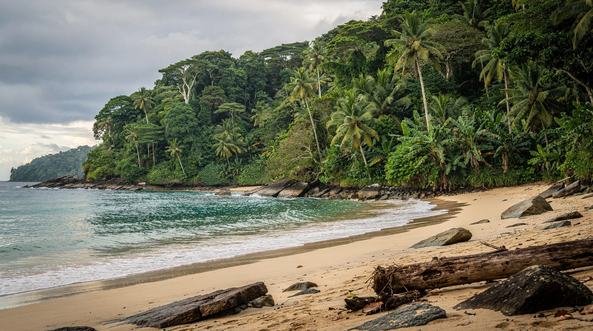
Hidden beaches in Costa Rica off the radar
Quiet beaches off the radar?
Playa Cativo, Punta Banco, Junquillal, Carrillo, Playa Mantas.
Why quiet beaches require effort — and why that is the point
Every beach that appears on a “top 10 Costa Rica beaches” list in a major travel magazine has, by definition, stopped being a hidden beach. Tamarindo, Manuel Antonio, and Playa Conchal are beautiful, but they are also crowded, developed, and well-serviced in a way that removes the surprise and discovery that make beach travel meaningful.
The beaches in this guide are different. They share a characteristic: getting to them requires planning, a 4WD, and some tolerance for basic facilities. In exchange, you get deserted shorelines, wildlife that has not been habituated to crowds, and the specific quality of silence that disappears the moment a beach becomes popular.
This guide is honest about access difficulty. None of these beaches are “secret” in the sense that no one goes — they are quiet because the logistics filter out casual visitors. The right traveller — patient, self-sufficient, genuinely drawn to the natural over the comfortable — will find these among the best experiences Costa Rica offers.
Playa Cativo — the most secluded luxury beach on the Osa Peninsula
Playa Cativo sits on the Golfo Dulce, the deep, calm gulf that separates the Osa Peninsula from the mainland to the east. It is accessible only by boat — a 45-minute ride from Puerto Jiménez or 25 minutes from Golfito. There is no road. There is no mobile signal. There is one lodge: Playa Cativo Lodge, a 13-room property with a sustainable ethos and prices starting around $450/night (meals and boat transfers included).
The beach itself is a 500-metre arc of dark sand at the edge of primary rainforest. Scarlet macaws nest in the trees above the beach. In the early morning, you may share the sand with a tapir or white-lipped peccary. The Golfo Dulce water is calm — the gulf acts as a natural barrier to Pacific swell — and warm (27-28°C year-round).
Who this is for: Travellers willing to pay for exclusivity and genuinely interested in wildlife. This is not a budget or even mid-range option — Playa Cativo is an eco-luxe destination with very high rates for a reason. The alternative is arranging a day trip by boat from Golfito or Puerto Jiménez, camping at the nearest permitted zone, and returning before dark.
Getting there: Fly or drive to Puerto Jiménez (Sansa operates daily flights from San José, $90-130 one-way), then arrange a lodge boat transfer. The Drake Bay destination guide has logistics for the Osa Peninsula approach.
Punta Banco — olive ridley turtles and a village-scale surf break
Punta Banco is 25 km south of Pavones on the Osa coast, reached via a deteriorating 4WD dirt road that most rental car agreements technically prohibit. The village has perhaps 200 inhabitants, one pulpería, one small guesthouse (Rancho Burica), and one reason visitors make the effort: the Punta Banco tide pool walk and the Rancho Burica olive ridley turtle monitoring project.
Olive ridley turtles nest on the remote beaches between Punta Banco and the Panamanian border from August through December. The local ASANA (Asociación ANAI) monitors nests and welcomes volunteer observers during nesting season. This is not a packaged tour — it is participation in actual conservation work at one of the most remote nesting beaches in Central America.
The beach at Punta Banco itself is a long, exposed stretch of grey sand with an inconsistent surf break that Pavones surfers visit on south swell days when Pavones is too crowded. Non-surfers will find the main draw to be the isolation itself.
Getting there: 5.5 hours from San José to Golfito, then 1.5-2 hours on dirt road to Punta Banco in a solid 4WD. Alternatively, water taxi from Golfito operates irregularly. This trip requires planning and local contacts.
Playa Junquillal — the forgotten Guanacaste beach
Junquillal sits 30 km south of Tamarindo on a secondary road that leaves the coast highway near Santa Cruz. The beach is 3 km long, backed by mangroves and dry forest, and has been overlooked by the Guanacaste resort development machine entirely. There is a small village, a Blue Flag certified beach (Bandera Azul Ecológica), and one resort (Hotel Guanamar, $80-120/night) that has been operating since the 1980s without significant expansion.
The surf at Junquillal is a right-hand beach break that works in north-northwest swells and is surfed mainly by residents from Santa Cruz. The beach is wide enough that even on weekends it does not feel crowded. Leatherback turtles (baulas) nest on Junquillal between October and February — the nearby Las Baulas National Park has official monitoring, but the section of Junquillal beach outside park boundaries receives independent arrivals that are rarely observed by tourists.
Getting there: 45 minutes from Santa Cruz on a paved road to Paraíso, then 12 km of gravel to Junquillal. A regular 2WD is fine in the dry season; 4WD recommended in green season.
Playa Carrillo — the pocket perfection south of Sámara
Carrillo is 5 km south of Sámara on a paved road, and it is one of the most strikingly beautiful beaches in Guanacaste despite receiving almost none of the tourist attention that its neighbour commands. The beach is a compact half-kilometre crescent framed by palms, facing a sheltered bay with calm, swimmable water.
What makes Carrillo genuinely quiet is the absence of accommodation directly on the beach (the only hotel on the point is El Sueño Tropical, $90-140) and the fact that there is no town, no restaurant strip, and no tour operator office. Visitors drive down from Sámara for the afternoon, use the protected public area, and leave.
Sansa operates daily flights from San José to the Carrillo airstrip (15-minute flight), and this is actually the easiest way to reach the area — a week based in Sámara with day trips to Carrillo is a genuinely excellent quiet-beach approach to the Nicoya Peninsula.
Getting there: 5 km from Sámara by paved road, bicycle-accessible in 20 minutes.
Playa Mantas — surf and solitude south of Nosara
Playa Mantas (sometimes called Playa Ostional on some maps) sits 8 km north of Nosara, accessible by a rough dirt track that requires a 4WD or mountain bike. The beach is named for the manta rays that patrol the offshore waters and are sometimes visible from the beach in calm conditions.
The surf at Playa Mantas works on larger swells when the more-accessible Nosara breaks (Guiones, Pelada) are overwhelmed. It is surfed almost exclusively by residents and visiting surfers who know about it — there is no sign, no parking area, and no marker on the road.
The Ostional Wildlife Refuge, which shares this stretch of coast, is the most important olive ridley nesting site on the Pacific coast of Costa Rica. The mass arrival nesting (arribada) typically happens during the waning moon between August and December, when thousands of turtles arrive over 3-7 nights to lay eggs. The spectacle is extraordinary and can be observed under the oversight of MINAE rangers and local cooperative guides.
Getting there: From Nosara, drive north toward Ostional village (30 minutes on dirt road). From the village, the beach access to Playa Mantas is an additional 15-minute walk or drive.
Playa San Josecito — Golfo Dulce’s snorkel gem
San Josecito is a small beach on the eastern shore of the Golfo Dulce, between Playa Cativo and the town of Golfito. There is no road access — it requires a 20-minute boat ride from Golfito. The beach is backed by tropical dry forest and fringed by an intact coral reef that is among the healthiest accessible reef systems in the Pacific of Costa Rica.
Snorkelling here is genuinely exceptional on calm days: the Golfo Dulce’s protected waters reduce visibility-killing sediment, and the reef section just offshore holds angelfish, parrotfish, and regularly visiting sea turtles. A handful of operators in Golfito run half-day snorkel tours to San Josecito ($40-60 per person including equipment).
Getting there: Golfito is reached by daily Sansa flight from San José or a 7-hour drive via San Isidro de El General. Boat transfers to San Josecito from Golfito dock operate on request with local operators including Captain Tom’s Rentals.
Practical guidance for finding quiet beaches
The pattern across these hidden beaches is consistent: they require either a 4WD (Junquillal, Punta Banco, Playa Mantas), a boat (Playa Cativo, San Josecito), or a short hike from the nearest accessible point (Punta Mona at Manzanillo). None of these is a dealbreaker — but all require more planning than driving to Tamarindo.
Some practical notes:
- Rental car agreements: Check your rental car contract. Many standard agreements prohibit unpaved roads, and some beaches on this list require rough dirt tracks. Toyota 4Runner, Mitsubishi Outlander, and Suzuki Jimny are the typical 4WD options available at Costa Rica rental agencies.
- Mobile signal: Many of these beaches have no signal or only intermittent coverage. Download offline maps (Maps.me or Google Maps offline) for the surrounding area before you leave.
- Water and food: Almost none of these beaches have vendors. Bring enough water for the day plus extra in case you get delayed. A packed lunch from the nearest town is the only reliable food option.
- Tides: Several of the beaches above (San Josecito, Punta Banco) have reef access that is tide-dependent. Download a tide chart for the specific date and location via the IMN (Instituto Meteorológico Nacional) Costa Rica tide service or the Tide-X app.
Frequently asked questions about hidden beaches
Are any of these beaches genuinely secret?
No. In 2026, no beach in Costa Rica within vehicle or boat range of civilisation is truly unknown. What makes these “hidden” is the effort required and the consequent self-selection of visitor type. These beaches are quiet, not secret.
Do I need a guide to visit these beaches?
Not for Junquillal or Carrillo — both are straightforward and freely accessible. For Playa Cativo (boat), San Josecito (boat), and Punta Banco (rough road + turtle monitoring), working with a local operator improves both safety and experience quality. For the turtle nesting observation at Ostional and Punta Banco, joining a licensed MINAE-affiliated guide group is legally required for the nesting beach itself.
What is the best time of year for remote beach visits?
The dry season (December-April) makes 4WD road access easier and reduces the risk of getting stuck. However, the green season (May-November) offers lush scenery, fewer visitors, and — for turtle nesting beaches — the prime observation season. Many of the Osa and southern Pacific beaches are only practical to visit in the dry season without a high-clearance 4WD.
Is camping allowed at any of these beaches?
Designated camping exists at several national park and refuge areas. Camping at Ostional Wildlife Refuge requires prior authorisation from SINAC. The beach section of Playa Junquillal outside the Hotel Guanamar property is technically public land. Wild camping at remote beaches is a grey area — Costa Rican law guarantees public beach access but does not explicitly permit overnight stays. Ask at the nearest ranger station.
Are the hidden beaches safe?
The primary safety considerations are the same as all Costa Rica beaches: riptides, rough roads, and remote locations with limited rescue access. Bring a charged phone with offline maps, tell someone your intended route and return time, and carry basic first aid supplies. The Osa Peninsula beaches in particular are far from medical facilities — the nearest hospital is in Golfito or Ciudad Cortés.
Where to fit hidden beaches in your itinerary
Most of the beaches on this list work as extensions to established destination circuits rather than standalone trips. Playa Cativo and San Josecito fit into the 12-day south Pacific itinerary. Junquillal and Carrillo fit naturally into a Sámara or Tamarindo base stay. Punta Banco and Playa Mantas are genuinely remote additions for travellers building a custom circuit around the Osa and Nicoya.
For the full Guanacaste beach orientation including known beaches, see the Guanacaste beach guide. For Nicoya Peninsula beaches, see Nicoya peninsula beaches.